Geo Data Visualisation
In this subsection we were forced to present our fantastic maps as gifs since the resulting size of html code exceeded 500 MB and thus it was impossible to push it to the git repository.
We created interactive maps in Bokeh to see how conflicts in Africa are related to the location. Based on them we have the opportunity to investigate the relative position of the countries, their size, and other geographical properties.
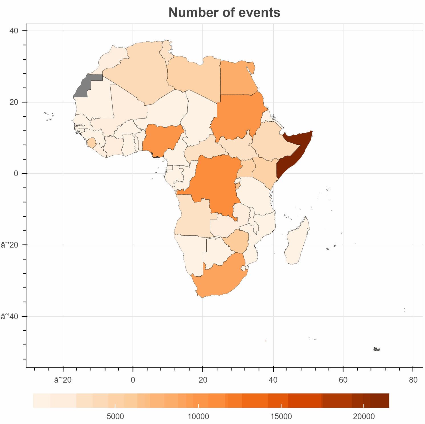
In the map above we can see the total number of conflicts for each country. The most noticeable is the intense color of Somalia which means that there were much more conflicts than in other places in Africa. The same conclusion was drawn from the previous analysis. We can also observe a high number of conflicts existing in the biggest countries. The grey color on the map in Western Sahara is caused by not having data for this region in our dataframe.
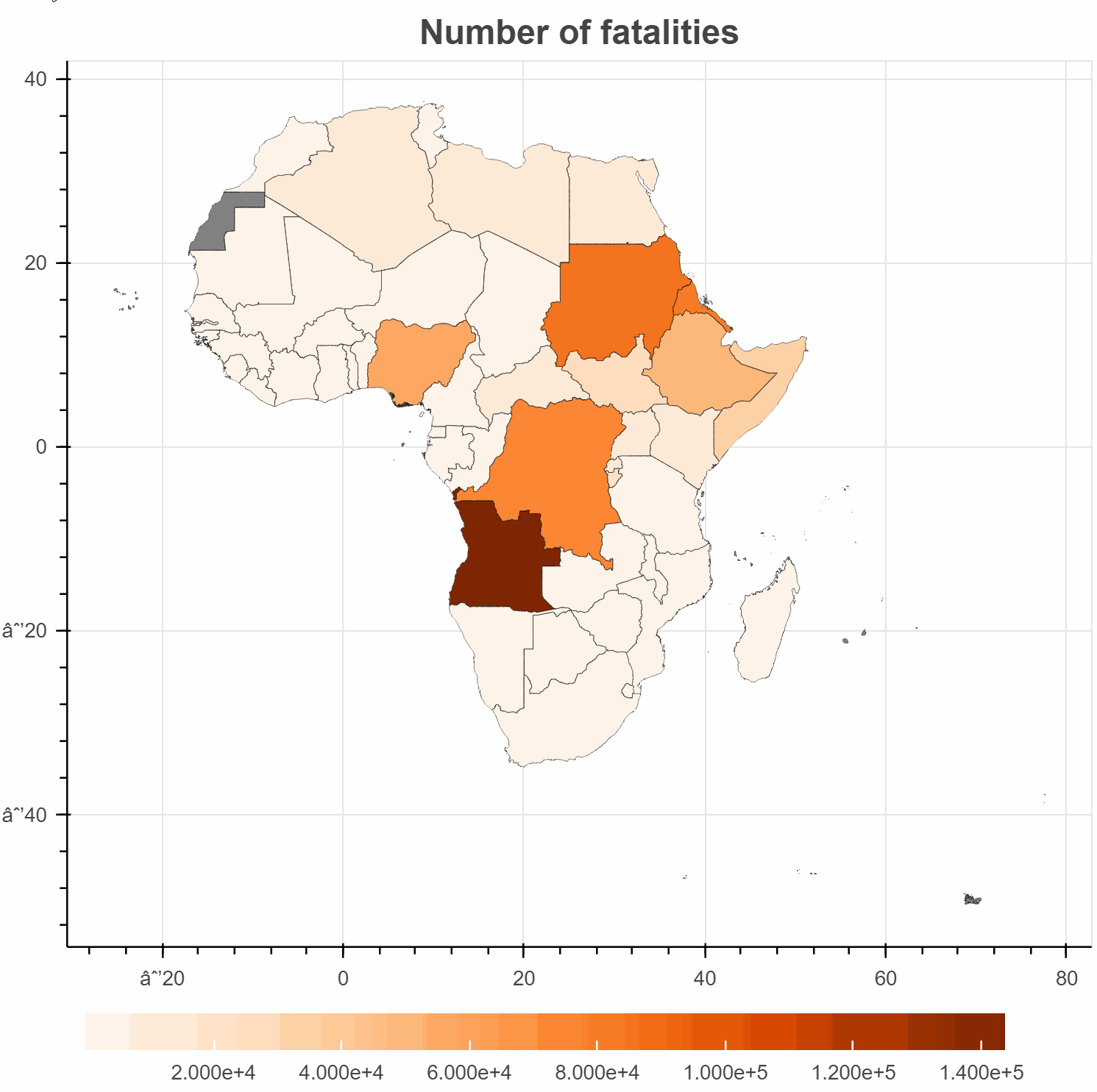
Showing number of victims per each country on the map is a great way to find information about wars and conflicts between countries. For evample we see Erithrean-Ethiopian War, Angola Civil War, The first Congo War, and Somalia Civil War.
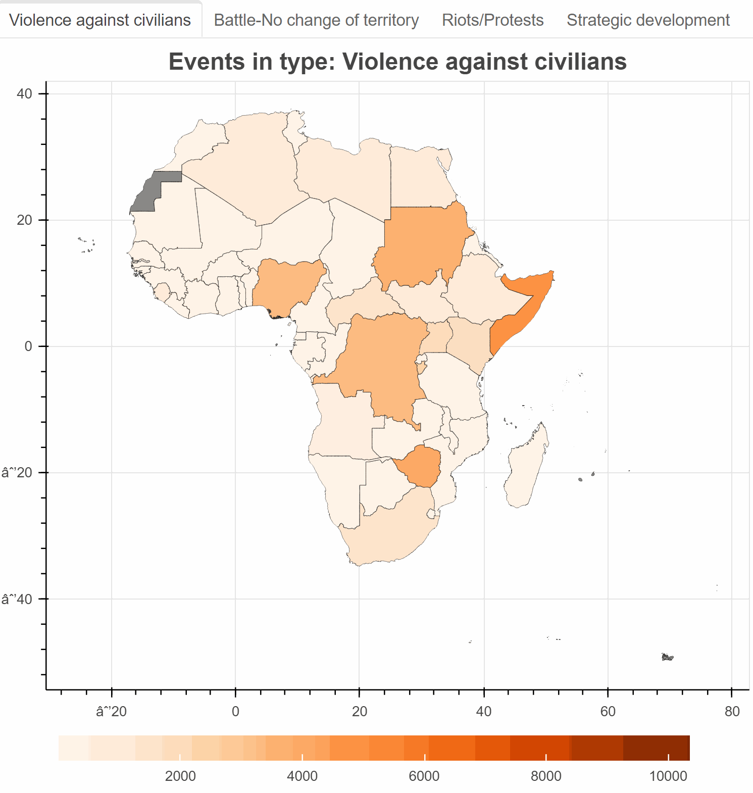
From below map, where we can change types of conflicts, we can see how each category of events is related to its place. By having the same scale in each map we can easily compare types between each other. From Violence against civilians and Battle-No change of territory we can observe similar behavior like in the previous analysis because these types are the highest in number, thus they are seen the most clearly in each analysis. However, when looking at Riots/Protests we can investigate some new conclusions, for instance about South Africa, Algeria, Nigeria, and again Egypt. These countries could not be seen in other visualization because they were overweighted by other countries with a high number of events in other types. THe whole map with Strategic development type is really light in colors, thus we see that the first 3 types make a majority of conflicts in Africa and have the greatest impact on the prevailing situation there.